
Natural Earth Wall Mural/Map (2015)
Another project I've done myself, initially suggested by a friend looking for something, but couldn't quite find what they wanted.
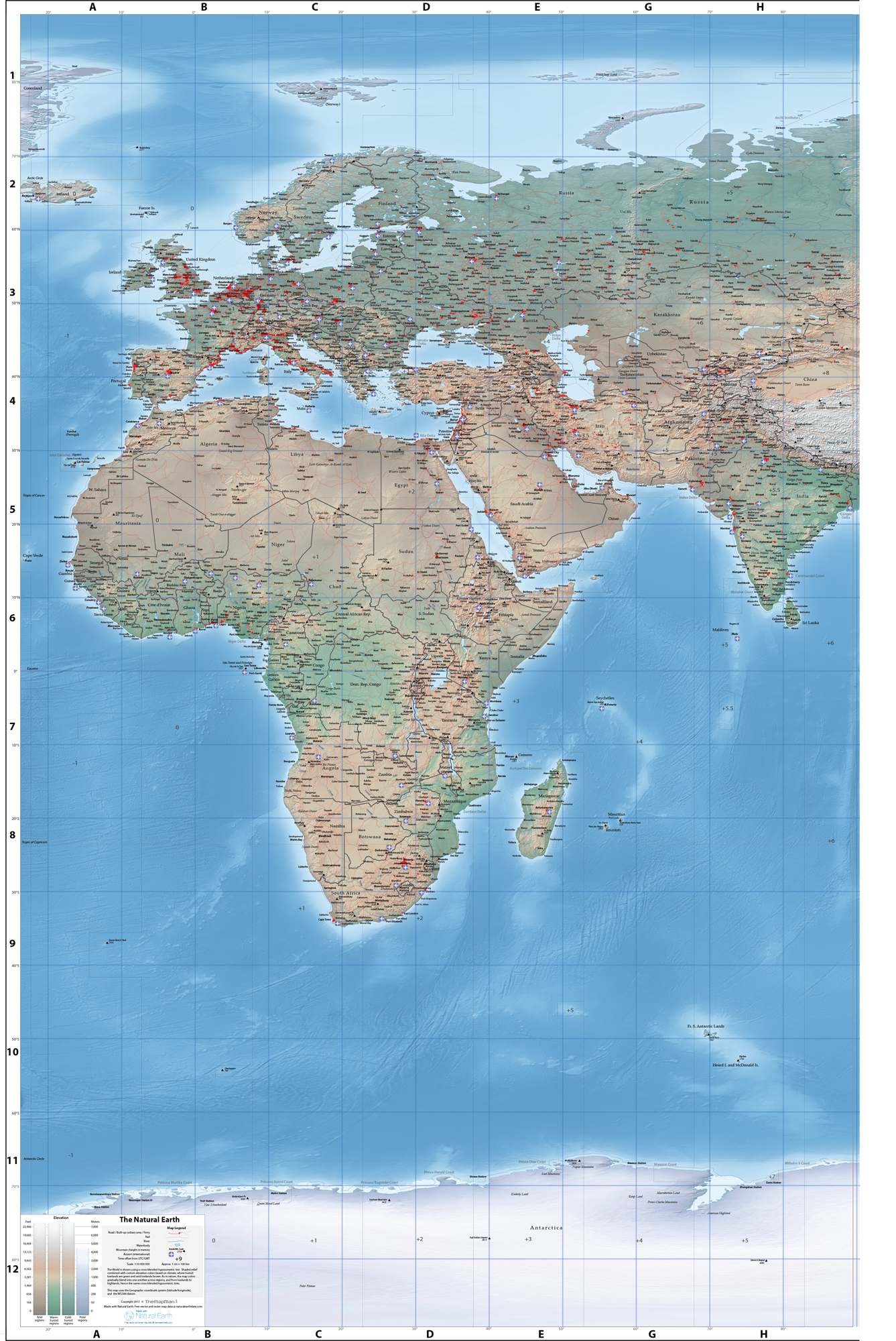
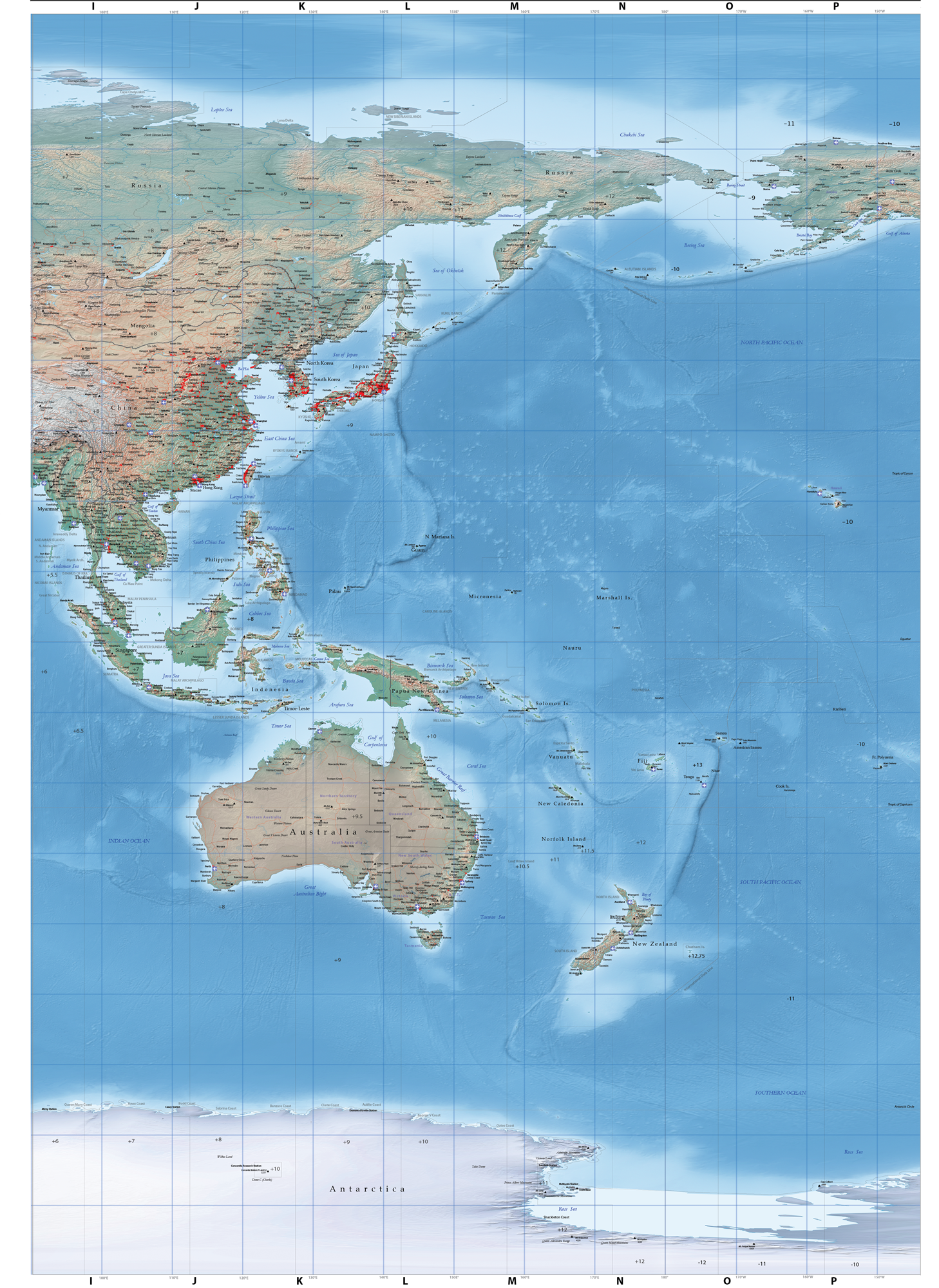
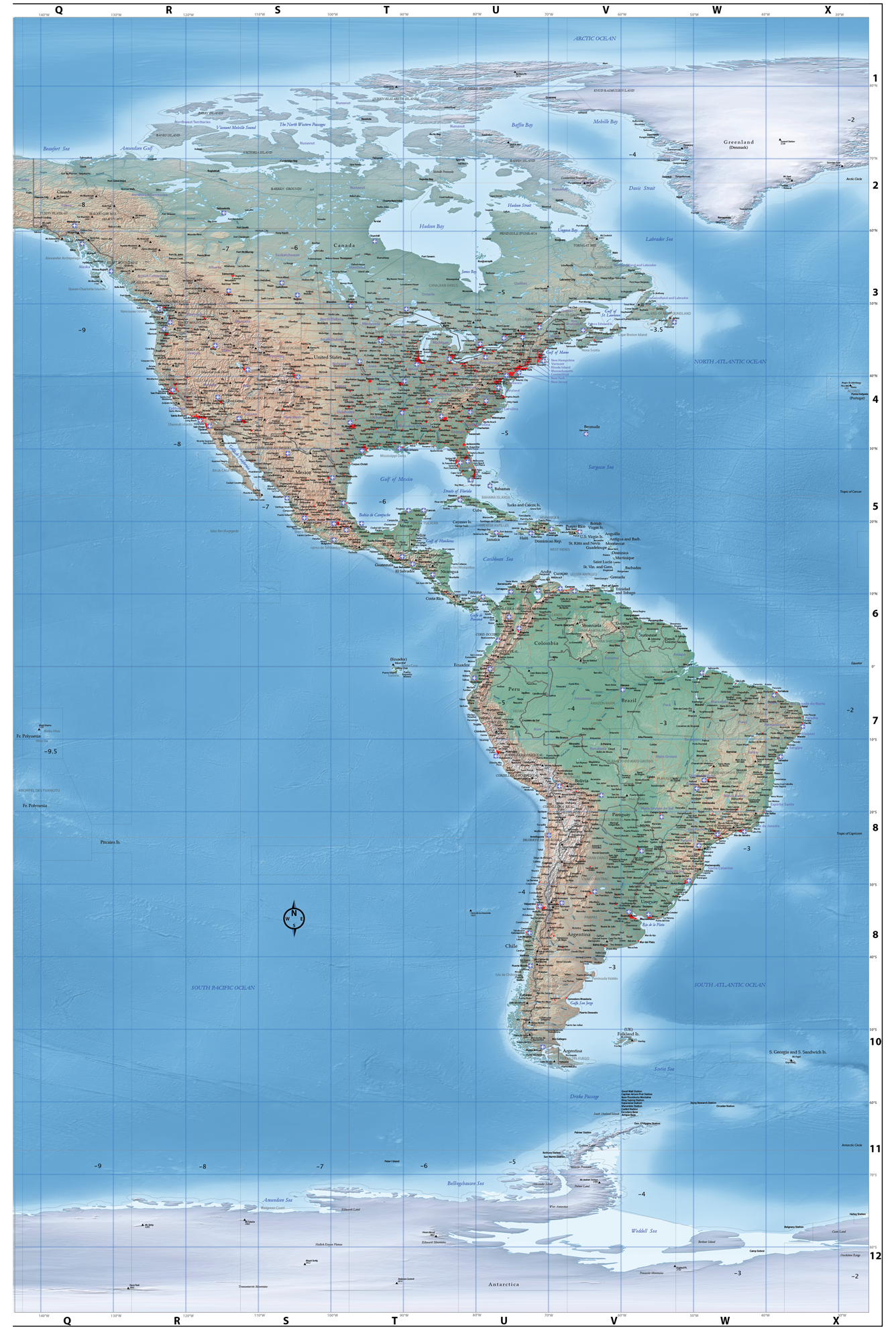
The world map is comprised of three panels, each measuring approximately 1.5m wide x 2m high. The map is available as a standard product showing all data layers (below), or can be costomised as required, at no extra cost.
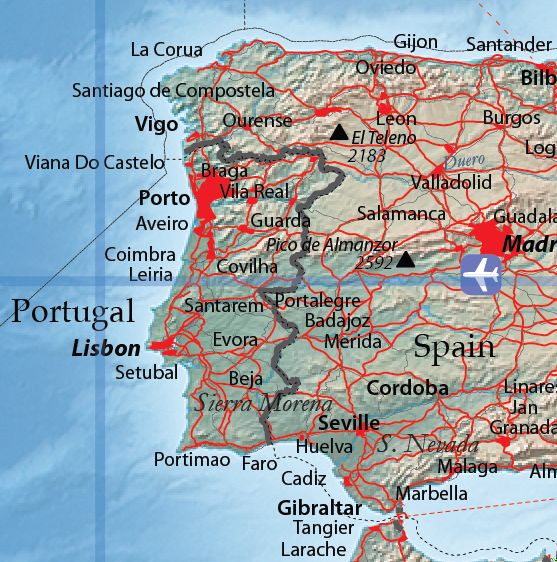
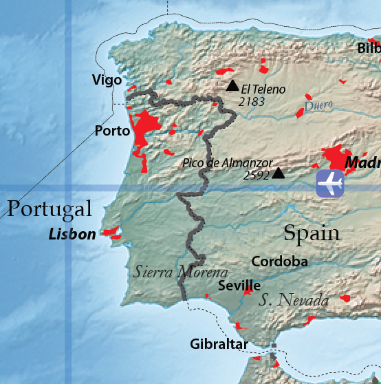
Here are samples of the std. map and one without all town names, road, and rail..
Map data layers include the following:
- Place Names - Towns, Major Cities, Capital Cities - regional significance over population census in determining selection of places. Over 7000 place names across the three panels. Exact spelling may differ in some cases given cultural preference.
- Main Roads / Ferry Routes
- Railways
- Populated (Urban) Areas
- Prominent Physical Features
- International Airports
- State Boundaries / Names (where applicable)
- Country Boundaries / Names - There are 247 countries in the world. Greenland as separate from Denmark.
- Shaded relief backdrop - available as either full-colour cross-blended hypsometric tint (std.), or a greyscale tint - derived from the latest NASA SRTM.
- Major Rivers
- Oceans / Seas
- Elevation Info. - Name + elev (m)
- Timezone Info. - offset number from GMT, boundaries
- Graticule / Grid - Latitude + Longitude at 10 degree intervals
- Main Geographic Lines - Tropical and polar circles, equator, and International Date Line.
The panels can be purchased individually, or as a set. The map can be printed in sizes ranging from a width of around 60cm (for reasonable clarity), upto a full size width of 1.5m (for each panel) - thus at full size you need about 4.5m of blank wall space for all 3 panels.
I'll also be creating a slightly smaller, single sheet, and easier to handle, world map during 2016.
The maps are based on the freely available 'Natural Earth' data available from http://www.naturalearthdata.com/
Part of the reason behind this project was to see what kind of map I could produce using free online data, and free tools, such as QGIS. Although I do admit that I used Adobe products for a lot of the work - and they weren't free.
Here are some examples of the available maps.
Note: each panel matches up perfectly with the others, enabling you to arrange them in any order ie. have the aust/asia panel in the middle, far left or far right. Here the border info has been edited for the Asia panel to sit in the middle.
Full Size, panels are approx 1.5 x 2 metres each.
Copyright © 2016 TheMapMan