
![]()
![]()
Below are some examples of work completed.
Another project I've done myself, initially suggested by a friend looking for something, but couldn't quite find what they wanted.
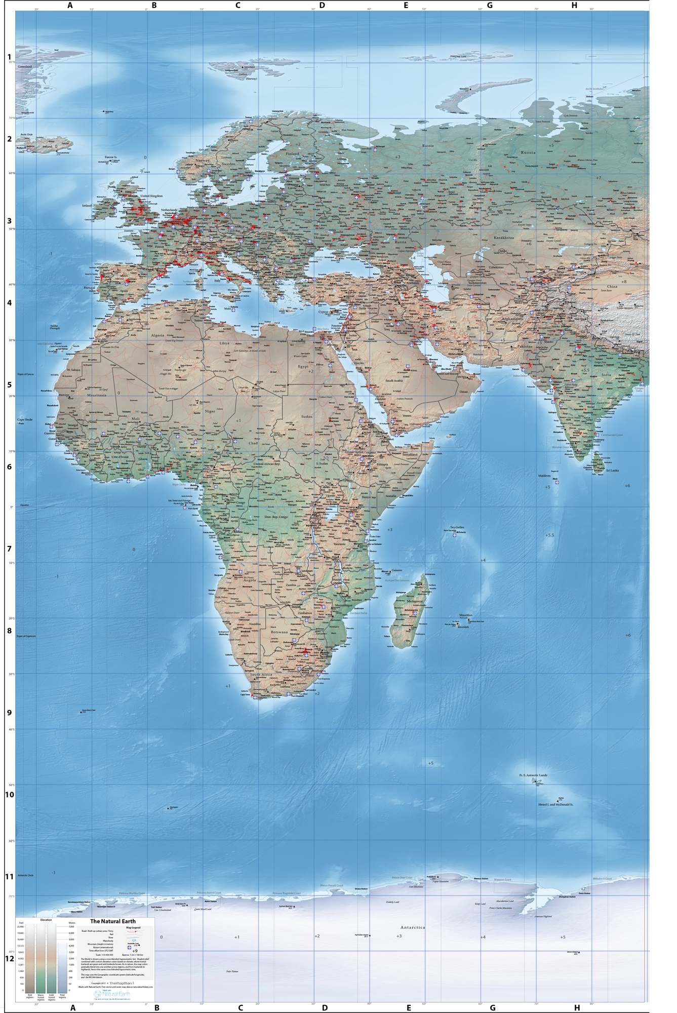
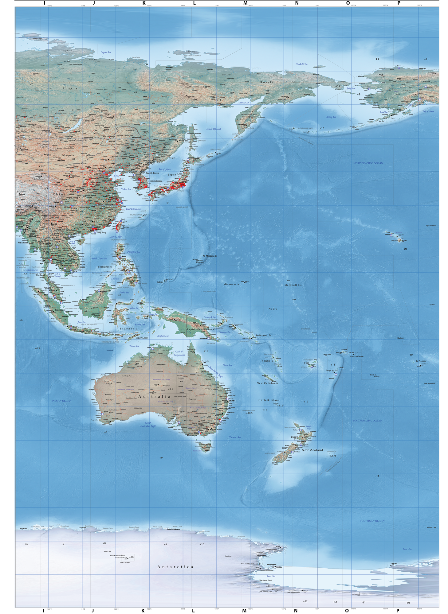
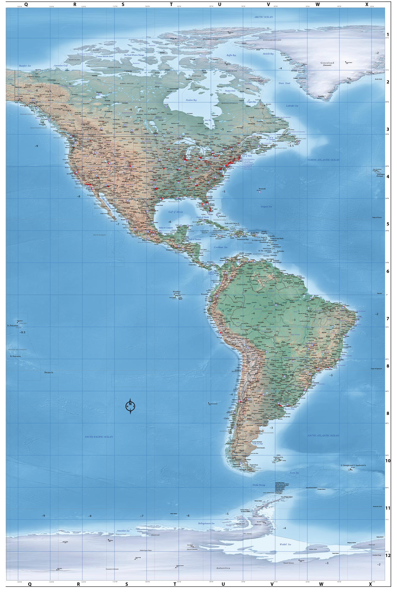
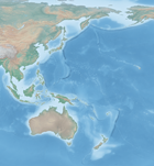
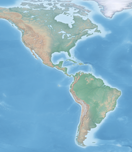
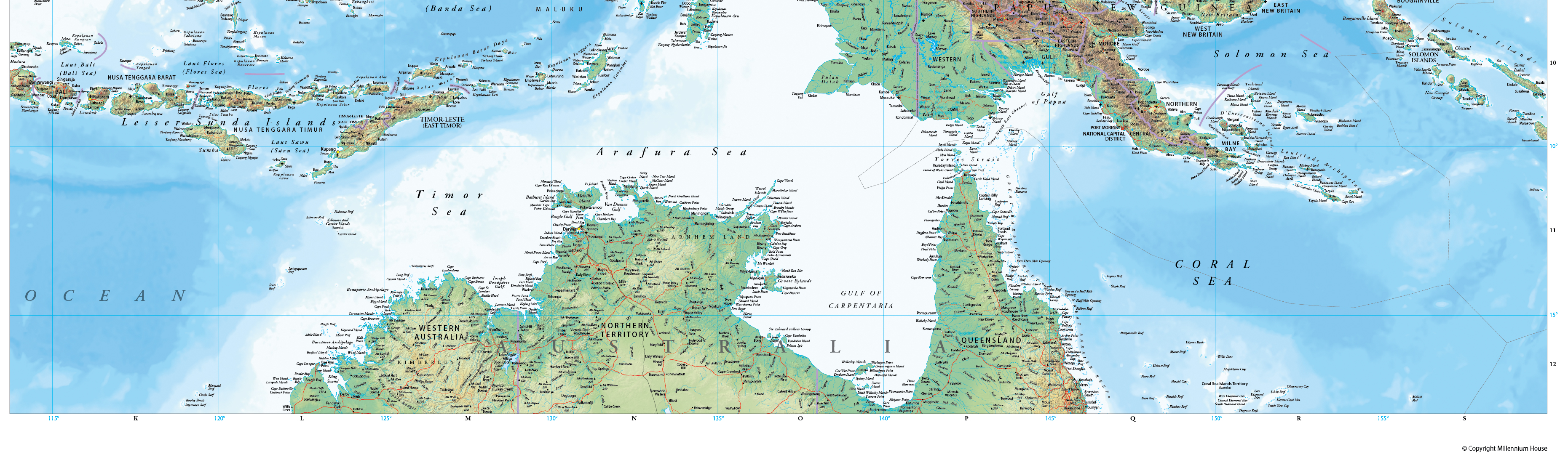
The world map is comprised of three panels, each measuring approximately 1.5 x 2 metres. Some of the map data layers included are Towns/Cities, main roads, railways, and prominent geographic features.
The panels can be purchased individually, or as a set. The map can be printed in sizes ranging from a width of around 60cm, upto a full size width of 1.5m (for each panel), thus at full size you need about 5m of blank wall space.
I'll also be creating a slightly smaller, and easier to handle, world map - most likely early 2016.
The maps are based on the freely available 'Natural Earth' data available from http://www.naturalearthdata.com/
Part of the reason behind this project was to see what kind of map I could produce using free online data, and free tools, such as QGIS. Although I do admit that I used Adobe products for a lot of the work - and they weren't free.
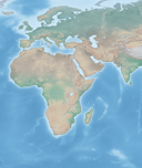
Here are some examples of the available maps (background image shown only here ie. excluding all data themes).
Note: each panel matches up perfectly with the others, enabling you to arrange them in any order ie. have the aust/asia panel in the middle, far left or far right.
Full Size, panels are approx 1.5 x 2 metres
Reduced Size, panels are approx 1.5 x 1.6 metres
 (1.5mb)
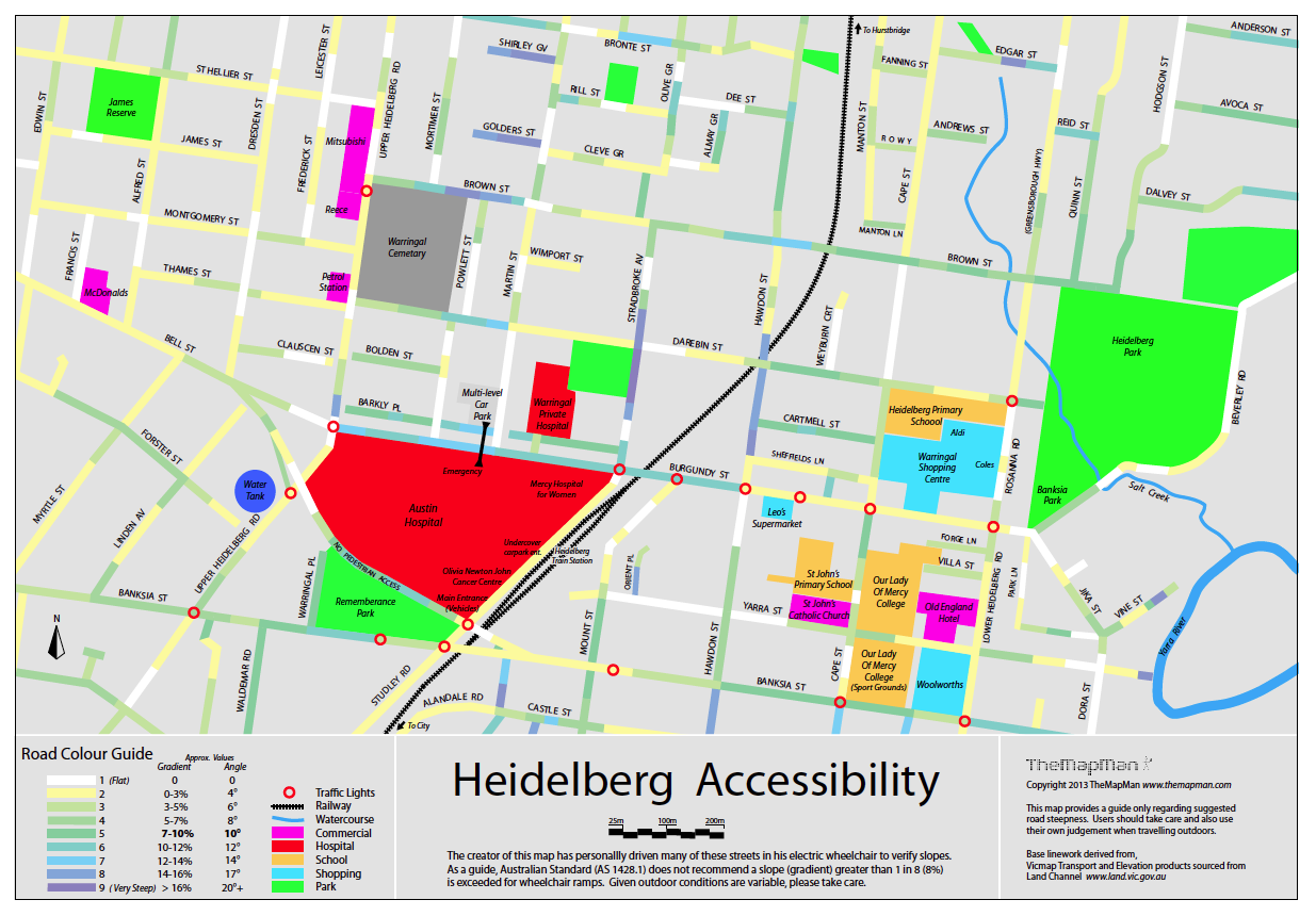
I developed this map in my own time based on personal field work and data from the Vic Dept. Environment & Primary Industries (www.land.vic.gov.au). The map was ceated with Adobe Illustrator.
I have since supplied it to the local council, Austin Hospital and Warringal Private Hospital.
 (5.3mb)
Earth is the world's largest Atlas, measuring 6ft x 4.5ft.
Maps were compiled automatically in a GIS, followed with editing by Cartographers to correct names, linework, positioning etc. Editing work was performed in Adobe Illustrator with the Cartographer working from marked-up sheet maps (full size) or PDF files.
These are some of the projects completed while I was a Sensis employee (for almost 15 years).
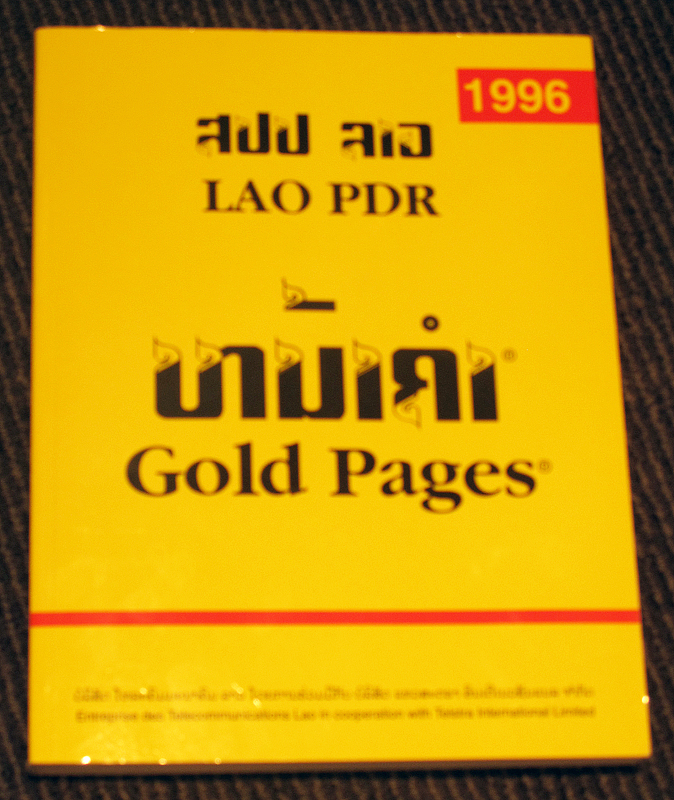
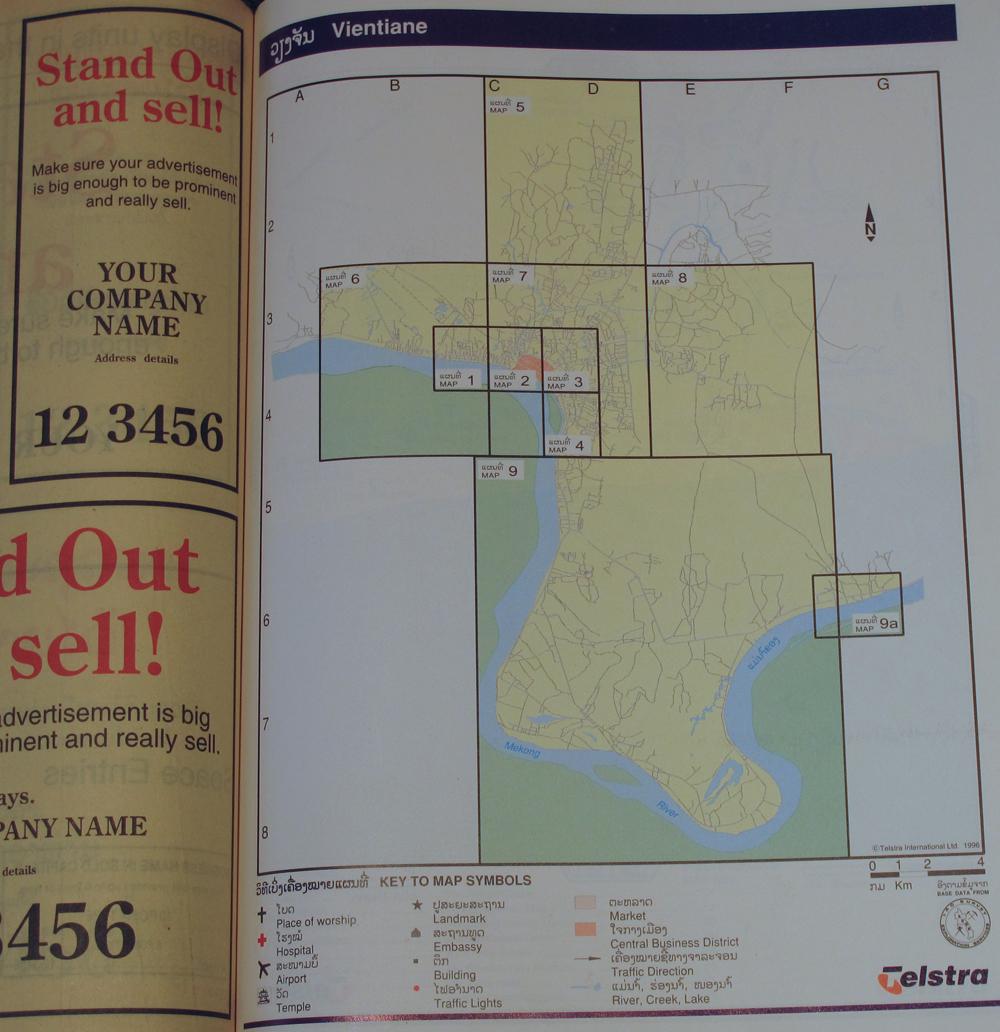
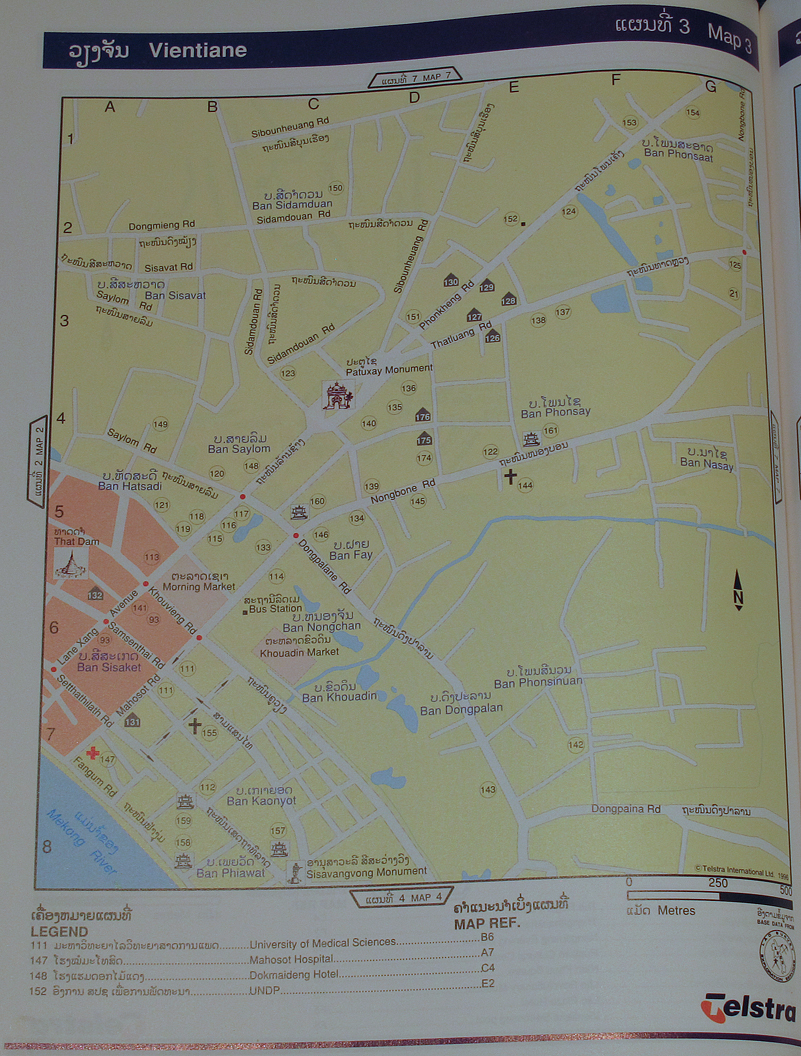
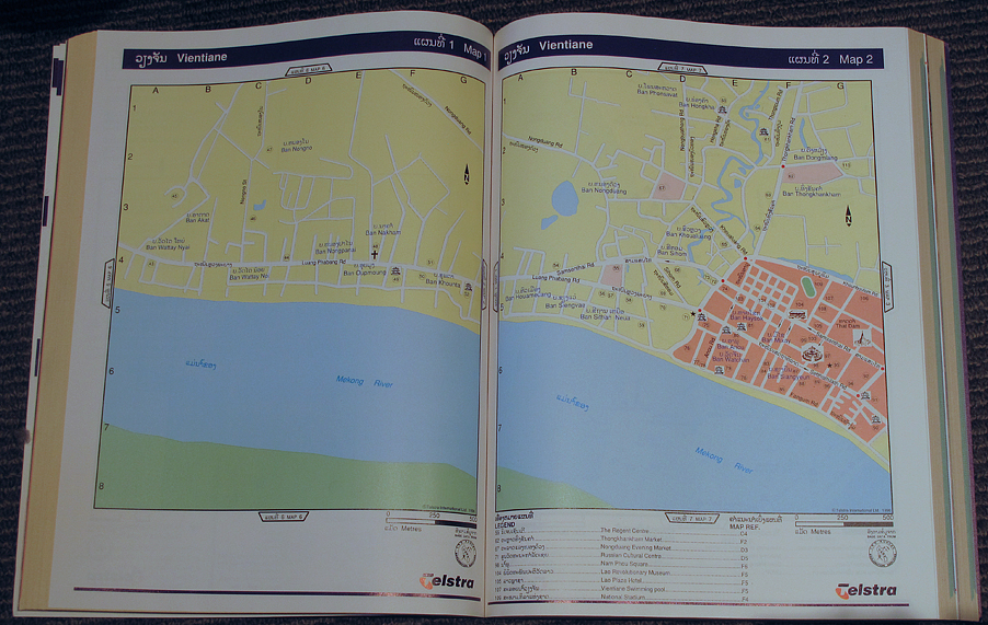
This project involved working with an editor in Laos to compile a series of 10 street maps (in English and Lao) from original survey data. All work was performed in Adobe Illustrator with high resolution colour separations produced prior to printing.
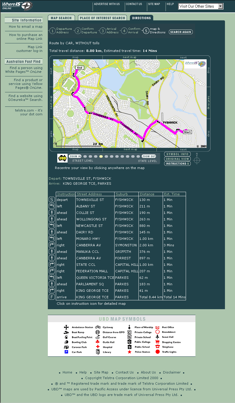
While managing Whereis.com Mark was involved in a number of interactive mapping activities, online. Mark was primarily responsible for design, functionality, map database construction, management and operations, working closely with a developer (who did all the necessary coding).
Some projects involved liaising with numerous external clients. As it was relatively early in the evolution of the 'Web' (late 90's) it was considered innovative for its time.
|
Whereis.com Map (1999) & Whereis.com Directions (2001) 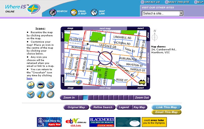
 |
Herald Sun Tour (2000) 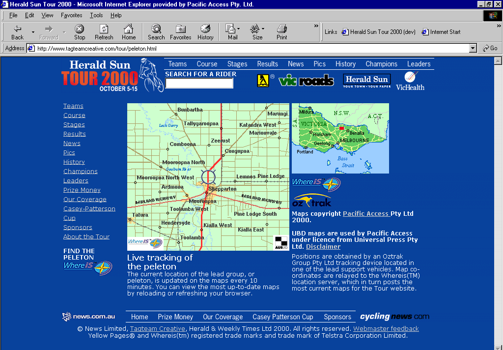 |
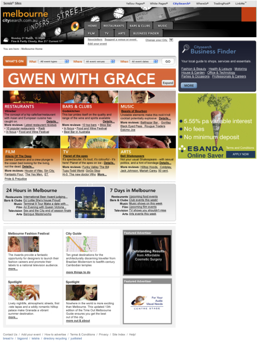
CitySearch.com.au (2007) 
 |
|
WhitePages (1996) 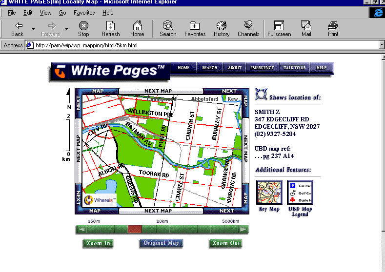 |
Targa Tasmania Rally (2001) 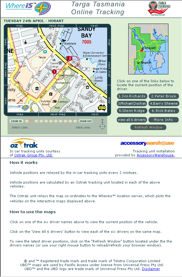 |
Compaq Dealer Locator (2001) 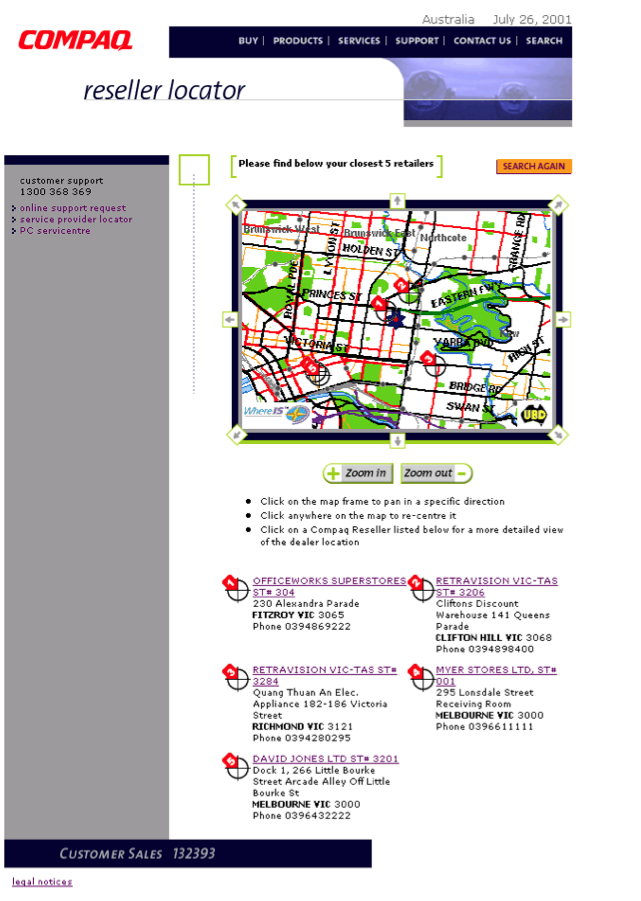 |